The $20m flip: The story of the largest land grab in the Brazilian Amazon
by Fernanda Wenzel on | Translated by Maya Johnson
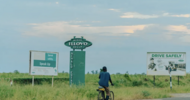
ALTAMIRA, Brazil — The warehouse donated to house the Castelo dos Sonhos farmers’ market for local growers has stood empty for nearly 15 years. Opened in 2008 and spanning 480 square meters (5,170 square feet), the farmers’ market on the outskirts of the city of Altamira in Brazil’s Pará state operated for just seven months; there simply wasn’t enough açaí berries, honey, fruits or vegetables to fill its tables. Since then, the building has sat empty, in stark contrast to the bustling pace of the lumber dealers, beef wagons and soybean trucks plying the BR-163 highway, and the constant buzz of chainsaws, whose wary operators emerged from the rainforest when we drove along the dirt roads that run parallel to the highway.
“There’s nothing to sell because nobody wants to be farmers anymore,” says a local who asks to remain anonymous. “Some of the people who used to farm or gather food are cutting planks in lumber mills; others are working for miners or cutting down trees.”
In this part of Brazil, the fear of speaking out against the big landowners is founded on a very real danger; a common threat here goes: “If you don’t want to sell the land, fine. The widow sells it cheaper.”
It was here, alongside the stretch of BR-163 running between the districts of Castelo dos Sonhos and Vila Isol in southeastern Pará, that the destruction of the largest continuous swath of Amazon Rainforest to date in Brazil took place. An area larger than Manhattan, this clear-cut was identified by MapBiomas, a research collective that tracks land-use changes via satellite imagery and has used its platform to gather and validate rainforest destruction alerts since 2019. The program draws from different monitoring systems, including the DETER system at Brazil’s space institute, and the deforestation alert system at Imazon, a research center that promotes conservation and sustainable development in the Amazon.
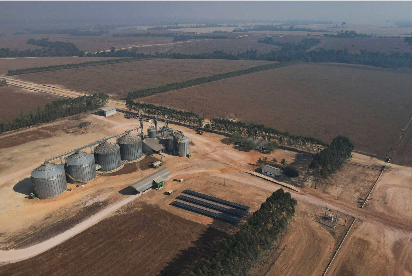
The clear-cut area identified by the satellites covers 6,469 hectares (15,985 acres) and was created between February and May 2020. The cost to clear this much forest is estimated at no less than $2.5 million. The land, which is now in the possession of land grabbers, lies in a region that belongs to the Brazilian federal government. What was once public land belonging to all Brazilian citizens now lines the pockets of three men who could receive more than $19.7 million in profit from its sale, and who broke Brazilian law when they cleared the forest without authorization from environmental agencies.
The land lies within the municipality of Altamira, but the closest urban center is the municipality of Novo Progresso, located in a region that strongly supported Jair Bolsonaro in the 2022 presidential election. The districts of Castelo dos Sonhos and Vila Isol (also known as “Kilometer 1,000”), like the wider municipality, have an economic elite who specialize in gold mining, clearing rainforest for timber, cattle dealings and, more recently, soybean monoculture.
“Soybean has grown in this region like cancer, like an addiction. There’s no way to go back now,” says Marcelo Reis, head of the local office of EMATER, the Pará state rural development agency.
The businesses along this stretch of BR-163 say much about the region’s economic profile: numerous stores that buy and sell gold, farm and feed supply stores, and repair shops for tires, tractors and backhoes — machines fundamental for mining and clear-cutting.
All these businesses were founded on one thing: the appropriation of public lands. “Land grabbing is a means for bringing more land to the market,” says José Heder Benatti, a law professor at the Federal University of Pará (UFPA) and ex-president of the Pará Land Institute. “What people do with this land depends on the economic cycle at the time.”
Not even two federal task forces against major deforesters in the Amazon were able to intimidate those illegally appropriating land in southwestern Pará — the Castanheira operation in 2014, aimed at a group led by Ezequiel Antônio Castanha, and Rios Voadores in 2016, which attempted to break up a ring led by Antônio José Junqueira Vilela Filho.
Instead, this region was the stage for the notorious “Day of Fire” in 2019, when a group of farm owners set hundreds of coordinated illegal fires, resulting in an international outcry. In 2020, Greenpeace would identify “new deforestation and land dealing practices” in the region, characterized by the fact that they were carried out “over extremely short periods of time.”
Responsibility for Brazil’s single-largest case of deforestation — which consumed some 3.5 million trees and killed more than 200 species of animals per hectare — falls on the shoulders of three men, according to IBAMA, Brazil’s federal environmental protection agency, and SEMAS, the Pará State Secretariat of the Environment.
The first of these is Jeferson de Andrade Rodrigues, who was fined 15.4 million reais ($3 million) by IBAMA and an as-yet-undisclosed amount by SEMAS for his part in the fire. Born in Paraná state in southern Brazil, Rodrigues is 45 years old and has worked with two supply stores in Castelo dos Sonhos.
Today, he deals in cattle, according to his WhatsApp profile and his many Facebook posts showing cattle being transported. Aside from his share of the land inside the Amazon’s single-largest deforested area, Rodrigues claims to own four other plots of land that, in fact, belong to the federal government. Two of them were clear-cut in 2021 and have been split up into smaller lots, a common practice in land grabbing that facilitates the legalization of the property through INCRA, the government’s land reform institute.
The second person accused of deforesting the 6,469 hectares is cattle farmer Delmir José Alba, aged 56. Tall and thin with a goatee, his casual dress (shorts, a T-shirt and a baseball cap) belies the assets, money and prestige that his family holds in the region. He recently sponsored the largest rodeo in Castelo dos Sonhos with another powerful farmer in the region: Manoel Alexandre Trevisan, known as “Maneca” and himself accused of involvement in the murder of community leader Bartolomeu Morais da Silva, or Brasília, 20 years ago.
Also born in Brazil’s south, in the state of Santa Catarina, Alba, who is known locally as “Nego Alba,” followed an uncle and a brother to Pará. They were among the first southerners to establish themselves in the area. At least part of his path to Castelo dos Sonhos can be pieced together by listing the environmental fines he racked up along the way.
Alba was hit with his first environmental fine in Conceição do Araguaia, a municipality on Pará’s border with Tocantins state, in 1995. The following year, he received a notice of infraction for setting fire to vegetation without IBAMA’s authorization in the municipality of Xinguara, 200 kilometers (124 miles) to the north. From 1997 forward, all of Alba’s fines arose from the BR-163 region between Novo Progresso and Altamira, where he finally settled down. Today, his IBAMA record lists 10 penalties for illegal deforestation and clear-cutting, illegal sale of timber, and breach of restraint, among other crimes. In total, the fines add up to 11 million reais ($2.1 million at the current inflation-adjusted rate). He’s only paid a fraction of that: just over 20,000 reais ($3,800), according to IBAMA’s system.
Rodrigues and Alba admitted to being responsible for removing the trees from the largest continuous area of deforested land in a statement made to the civil police in June 2020.
The third person responsible for the destruction is Augustinho Alba, a cattle farmer and Delmir’s brother. He was fined 22 million reais ($4.2 million) in 2020 for the 2019 incident. But that hasn’t appeared to dissuate him; the following year, Augustinho Alba was fined another 31.3 million ($6 million) for continuing to destroy the forest and prevent its regeneration.
In a legal document, his lawyer said “there is no correlation whatsoever between the land owned by Mr. Augustinho Alba and the deforested [land].” The document also said the deforestation happened on his brother Delmir’s land (with whom Augustinho claims to have broken all ties). This has since been verified by IBAMA, citing a misinterpretation of satellite images.
“Normally, each region has its local elite that keeps close ties with the mining and deforestation players,” says Ana Carolina Haliuc Bragança, the lawyer who once headed the Federal Prosecutor’s Office’s Amazonia Task Force, shut down in 2021. “This makes them hard to investigate because mapping these groups depends on a deep knowledge of local networks. Not to mention the fact that they operate completely outside the system, paying each other in hard cash, for example.”
A series of burns
The largest single act of deforestation in the Brazilian Amazon to date was carried out on the back of land belonging to Augustinho Alba (the fazenda, or ranch, of Santa Tereza) and his son, Gustavo de Jesus Alba (Fazenda Bom Jesus). Our reporters reconstructed the story from satellite images and analyses from the Center for Climate Crime Analysis (CCCA) — an NGO that works to bring to justice companies that contribute to global warming — and from Earthrise Media, which uses technology to drive environmental conservation.
Thanks to satellite imagery, the trail of deforestation can be reconstructed step by step, starting with the first signs of wood exploitation to the time that pasture grass was seeded for cattle ranching. It began about two decades ago, when a winding path was cleared into the forest in search of the trees that would fetch the highest prices on the timber market.
Heron Martins, who coordinates the CCCA’s geospatial analysis laboratory, says this is a traditional logging road. “With the money from selling this wood, the guy will finance his own clear-cutting, which means renting machines, hiring a workforce, buying grass seed and the first cattle herd.”
After years of cutting down only the high-value trees, wider roads were built in December 2019, so the land could be subdivided into large plots. Despite heavy cloud cover during the following months that sometimes impeded visibility in the satellite images, in February 2020, the first signs of massive clear-cutting were already visible. This stage would be completed in only four months.
A SEMAS team arrived at the location a few months later, in June 2020, when it found numerous felled trees (including protected species, like the Brazil nut tree) mixed with semi-felled trees — their trunks were cut about 70% through, leaving them prone to be knocked over by wind or by another tree falling on them. “This appears to be a technique used to slow down the deforestation alerts generated by remote sensors because, when trees are cut this way, they fall more slowly, sometimes taking weeks,” the inspectors said.
The SEMAS inspectors were aware that the land grabbers’ next step would be to set fire to the wreckage left behind, so they requested continued monitoring of the area by public agencies. Yet even though the burning was foreseen, it wasn’t prevented: three months later, fire would be used to effectively finish off the “cleaning” process and facilitate pasture grass growth.
“This case is typical of the clear-cutting that has been going on in Amazonia since the 1970s,” Martins says.
Analysis of the satellite images shows that the destruction was still going on in 2022. At the beginning of September, as we were finalizing the first report in this series, another round of burns was detected in the area, probably carried out to eliminate any native vegetation that had remained on the land.
Maurício Torres, a professor at UFPA with a Ph.D. in human geography from the University of São Paulo (USP), says land grabbing begins with two distinct processes. The first happens on the ground and consists of cutting down the forest: “Without deforestation, there’s no land grabbing because this is the main way to gain control of territory. The guy will later use this to show that the land is ‘productive.’ In other words, what one government agency sees as an environmental crime is seen by ‘land legalization’ programs as proof of occupation.”
While their employees carried out the heavy work involved in the first stage of land grabbing, Delmir Alba and Jeferson Rodrigues were working on the bureaucratic side of occupying public land. There’s no document easier to obtain than the Rural Environmental Registry, or CAR, which applicants acquire through self-declaration. The CAR system was created in 2012 to gather information on rural properties, but was subverted into a tool to facilitate land grabbing. In theory, state and municipal authorities would cross-check the information registered by applicants in the CAR system to prevent claims being staked to public lands. But in reality, few properties in the Amazon are checked this way.
In January 2020, Rodrigues created a CAR registry for the parcel of government land that he had appropriated: 2,420 hectares (5,980 acres) along the banks of the Rio Curuá, which he named Fazenda Vale do Curuá. Our reporters contacted Rodrigues, who confirmed owning a ranch within the deforested region. He said he had already passed on all the information to the legal authorities, but declined to offer further explanation.
In March of the following year, the remaining parcel of land (5,803 hectares, or 14,339 acres) appeared in the CAR system under the name of Delmir Alba as Fazenda Nossa Senhora Aparecida. Our reporters tried contacting Alba via his and his wife’s Facebook profiles but received no answer. We also reached out to two lawyers who had previously defended the cattle dealer, but both said they no longer represented him.
We visited the region in August 2022 but couldn’t enter any of the ranches. Security guards at the gates denied us access, stating clearly that the land has an owner.
‘Not just anybody has that kind of money’
There are two main methods for clear-cutting in this part of Pará, depending on the budget and, especially, the way the deforested land will be used.
The first method is known as quebradão, which translates loosely as “the big crush.” It was developed by the man notorious for being the Amazon’s most powerful deforester, Ezequiel Antônio Castanha. It consists of using chainsaws to cut only the largest trees. As they fall, these trees “crush” the smaller vegetation around them. The process leaves behind loose branches, fallen trunks and vines that require two rounds of burning to leave the land bare enough to plant grass.
Clearing a forest this way costs around 2,000 reais ($392) per hectare, or about $158 an acre, including labor, machinery and fuel. “It’s the cheapest method and is usually used by speculators who want to spend the least amount possible because their goal isn’t to produce, but rather to sell the land,” says a source who spoke on condition of anonymity.
But even with this cheaper method, Rodrigues and the Alba brothers would have spent about 13 million reais ($2.5 million) to remove the vegetation from the nearly 6,500 hectares identified in the satellite imagery. But the use of bulldozers (which was described by the SEMAS team) and the profile of those paying for the clear-cutting (cattle ranchers) indicates that the “big crush” was combined with the other method, which uses heavy machinery and therefore costs twice or three times as much per hectare. Renting a tractor costs around 500 (98) an hour, the same as an entire day’s pay for a chainsaw operator.
In this second model, machines are used to knock down the smaller trees, which is followed by the planting of grass seeds. Besides requiring only one burn to prepare the soil, this process is harder to detect with monitoring satellites because the tallest trees remain standing and hide the destruction going on beneath their canopy. Because it produces high-quality pasture in a shorter timeframe, this method tends to be used by those who don’t intend to just sell the land but also to produce on it.
“The deforestation of such a large area over such a short period shows that there are people with a lot of economic clout behind the deforestation,” says Martins from the CCCA.
“Not just anybody has that kind of money,” adds Torres, the UFPA professor.
But the investment should pay off quickly, either with cattle farming or selling the land to third parties. “If you invade an apartment and squat there for 10 years without paying any rent, you’ll save a lot of money, right? With land grabbing, it’s the same thing,” says Paulo Barreto, a senior researcher at Imazon.
The land cleared by the three farmers has a flat topography, making it the most sought-after type of land in the region. “This means it’s appropriate for soybean farming,” Torres says. And land suited for soy farming brings top dollar in these parts.
According to information from a regional land dealer, the selling price for cleared land in this part of Pará ranges from 10,000-35,000 reais ($1,900-$6,800) per hectare, or $770-$2,750 per acre. The land cleared by the Alba brothers and Rodrigues, with its flat topography and prime location near BR-163, will most likely be sold for at least 20,000 reais ($3,900) per hectare ($1,580 per acre), or a total of 130 million reais ($25.5 million) for the nearly 6,500 hectares — a figure more than twice IBAMA’s entire fire prevention budget in 2022.
Reigning from the Castle of Dreams
The sky darkens with smoke as we drive along BR-163 toward Castelo dos Sonhos (“The Castle of Dreams”), to the point where road visibility becomes impaired, and our throats become irritated. It’s the start of August, and the amount of smoke is a sign that this will be the worst August since 2010 in terms of the number of burns in the Amazon.
Castelo dos Sonhos was named after a song by Brazilian crooner and composer Walter Basso, whose lyrics include the line, “You are the queen in my castle of dreams…”
The song was popular among gold prospectors, the first group of outsiders to occupy this region in the 1970s. But for most people living here, life is no fairy tale; it’s a region riddled with land conflicts and where the haves are used to simply crushing out the have-nots. “Many people around here lost both their land and their lives,” says a local who asks not to be identified.
But for a small elite, the decision to try their luck in Pará led to an enviable empire. While Augustinho and Delmir took care of business in Pará, the third Alba brother, Ivanor, watched from a distance in their birth state of Santa Catarina, where he’s a surgeon. Together, the three brothers built an estate totaling more than 11,000 hectares and prospered from the cattle and soybean businesses.
But the actual value of their assets is unknown because of the common local practice of registering land under the name of third parties. Fazenda Santa Tereza, for example, isn’t registered under Augustinho Alba’s name in the CAR database but under that of his wife, Julia Rosa de Jesus. According to a lawyer for Augustinho Alba, this was because the land had been parceled out, and the process hadn’t been finalized by the time this report was published.
A few years ago, the brothers had a falling-out over business practices. Augustinho and Delmir’s share of the kingdom ended up on one side of the highway — and expanded through deforestation — while Ivanor’s part ended up on the other.
Augustinho, Delmir and Delmir’s wife, Diene Montagni, sold cattle to six meatpackers that exported beef to destinations including Hong Kong, the Congo, Thailand and the U.S. This information comes from livestock transit permits, or GTAs, issued to by the ranchers between 2018 and 2021 and later seen by our reporters.
The brothers’ largest client is Vale Grande, a company belonging to the Frialto group. At one point, Delmir Alba worked as the go-between linking the slaughterhouse with cattle ranchers in the region. In 2013, the company was charged by the Federal Prosecutor’s Office (MPF) with buying 5,370 head of cattle from farms located on illegally deforested land and 183 head raised on properties that had been blacklisted for subjecting their workers to slavery-like conditions.
According to data from the company Panjiva, between January 2019 and July 2022, Vale Grande’s units in the states of Mato Grosso and Rondônia exported 2.2 metric tons of beef, more than half of which went to the U.S.
The Alba brothers’ second-largest customer is Redentor, a meatpacker that bought 385 head of cattle from Augustinho Alba in 2018. The company, which has filed for judicial recovery, isn’t a signatory to TAC da Carne, a voluntary agreement under which meatpackers operating in the Amazon commit to not buying cattle from farms associated with illegal deforestation or slave labor. Still, the meatpacker recently received approvals to export to China once again. In 2019, Redentor sold 108 metric tons of meat to the Asian market.
In one document, Redentor Foods confirmed that it had slaughtered 385 head of cattle from Fazenda Santa Tereza, Augustinho Alba’s ranch, and that, at the time of purchase, the property met all legal requirements.
The Frialto group, owner of meatpacker Vale Grande, said it had signed the TAC da Carne after being charged by the Federal Prosecutor’s Office and added it would embargo properties not meeting the TAC’s requirements. Read the full responses from Redentor Foods and Vale Grande to our reporters here.
Prime target
The situation in Castelo dos Sonhos exemplifies how things work throughout the Amazon, not just because of the routine — extracting the most valuable standing trees, cutting down the rest of the rainforest, setting the area on fire, and then planting pasture grass — but because of the scenario. Brazil’s most extensive single spate of deforestation was carried out on unallocated public land, those areas belonging to the federal or state governments that haven’t been designated conservation units, Indigenous territories, logging concessions or private properties.
By law these spaces should be protected and designated for the use of local communities, as forest concessions or national forests. But in reality, unallocated public lands have become the No. 1 target of land grabbers. Forty percent of land clearing between 2013 and 2020 occurred on unallocated public land, according to Imazon data. And from 2019 to 2021, deforestation on unallocated land increased by 78% from the previous three-year period. According to Imazon, “this increase in deforestation is evidence that there is pressure for these lands to be privatized.”
“Land grabbers only go after land that is ‘grabbable,’” says Torres, the UFPA professor. “Unlike unallocated land, conservation units or Indigenous territories can’t be appropriated because they already have an allocated use and, theoretically, can no longer be extracted from public patrimony to be incorporated into the private patrimony of a land grabber.”
IBAMA, the federal agency responsible for protecting these areas of land, did not respond to our reporters’ inquiries.
According to an Imazon study, there are 143.6 million hectares (354.8 million acres) of unallocated public land within the Brazilian Amazon — an area larger than Peru’s national territory, comprising 30% of the total Amazon region. Besides the federal and state forests formally recognized by the Brazilian Forest Service (SFB), which is responsible for the National Public Forest Registry, Imazon’s number includes a vast territory for which there’s simply no information: this land has not been recognized by the SFB as unallocated forest, but it also doesn’t appear in public databases as Indigenous territories or protected traditional Afro-Brazilian communities (known as Quilombos), conservation units, settlements or private properties.
Video shows advance of deforestation in the Amazon area. By Júlia Coelho/The Intercept Brasil | Images by ESA Copernicus/Sentinel-2/Earthrise.
In a statement, the SFB said the registration of unallocated lands depends on information supplied by various public agencies, and that the SFB is merely responsible for allocating areas for forestry concessions.
FUNAI and ICMBio, the agencies responsible for the land allocation for Indigenous territories and conservation units respectively, did not respond to our team’s inquiries. Meanwhile, Brazil’s land reform agency, INCRA, which heads the management of land reform settlements and unallocated lands, did not clarify what its responsibilities are concerning the areas, merely pointing out that environmental protection falls under IBAMA’s jurisdiction. Read our reporters’ email correspondence with INCRA here.
Pará is where the pressure on unallocated public land is the most intense. According to a Greenpeace report, the “knowledge about land reform structure to be able to identify unallocated public lands” and later invade them is one of the main strategies of the organized criminal groups at work in the region. According to Greenpeace, 62% of the unallocated public forests near BR-163 have been registered in the CAR system. Deforestation in the region increased by 205% between August 2019 and July 2020 compared to the same period a year before.
This is why the designation of these areas, especially as Indigenous territories, has been identified as one of the most effective means of combating land grabbing and, subsequently, deforestation.
“In this speculation battle, a rainforest with people living in it is better off than a rainforest without people,” says José Heder Benatti, the law professor. “Forests with human occupation can fight back, while unoccupied forests can’t.”
But in southeastern Pará, things are going in the opposite direction. In 2003, a federal ordinance seized more than 300,000 hectares (741,000 acres) away from the Baú Indigenous Territory, home of the Kayapó people, following more than a decade of conflict with squatters, loggers, miners and politicians in the region.
After that, deforestation increased at an average rate of 129% every year, precisely in the region from where the Indigenous people had been removed, according to Imazon. Rodrigues and Delmir Alba are among the land grabbers who benefited from the decision.
To Maurício Torres, what happened with the Baú Indigenous Territory sparked a race that’s eating away not just at unallocated lands but also at protected areas, especially Jamanxim National Forest, which is the second-most deforested conservation unit in Brazil, according to INPE, the space agency.
“The taking of land from the Baú Indigenous Territory was facilitated by invasions and threats to the Indigenous people living there, telling them there would be a massacre if they didn’t concede,” Torres says. “It set a precedent for violence, terror and deforestation as a means for getting anything done.”
This article was originally published in Portuguese by The Intercept Brasil and is part of the Ladrões de Floresta (Thieves of the Forest) project, which investigates the appropriation of public land inside the Amazon and is funded by the Pulitzer Center’s Rainforest Investigations Network.