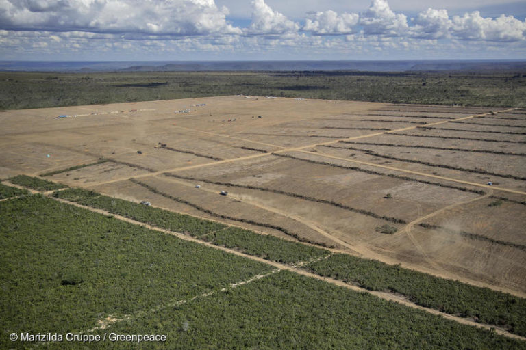
Deforested area in the municipality of Barreiras, Bahia state. This region is known as the “Ring of Soy,” because it encompasses large plantations, processors and soybean distribution centers. This part of the Brazilian Cerrado is notorious for its high deforestation rate and land conflicts with traditional people.
‘Digital land grab’ deprives traditional LatAm peoples of ancestral lands: Report
by Sue Branford
Georeferencing — a digital mapping technique increasingly employed by South American governments to register land ownership — is being regularly used by landgrabbers and companies to expel traditional communities from ancestral lands occupied for decades or even centuries, according to a report by GRAIN, an NGO that works with peasant communities around the world.
The innovative technology is also allowing a few powerful actors in the international financial sector to play a decisive expanding role in the transformation of large tracts of tropical rainforest and savanna into agricultural lands.
Georeferencing originates with a digital image, — an aerial photo, scanned geologic map or topographic map, for example — then adds geographic information to the image so that GIS or mapping software can “place” the image in a real-world location. When this digital process is used exclusively, and not coupled with more traditional surveying techniques, the process lacks confirmation via ground truthing, risking fraud.
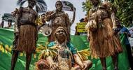
Land ownership registration in South America has been chaotic since colonial times, leading to many, sometimes violent, conflicts between Indigenous groups and traditional peoples, and a variety of outside land claimants encroaching on ancestral territories.
The lack of centralized governmental land registration systems offers landgrabbers an opening for claiming collective property occupied by traditional communities lacking legal deeds, with more than one claimant often registering the same plot. The disorder became so widespread in the Brazilian Amazon by the 1970s that people joked about property owners claiming “different storeys” for the same piece of land.
Analysts have long agreed to the urgent need for efficient and accurate land registration systems. But, according to the GRAIN report, the solution that South American governments have come up with is doing great harm to traditional communities.
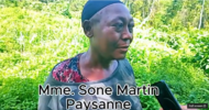
The main tool they are employing is georeferencing, a high-tech approach to registration that is completely alien to the hundreds of thousands of peasant families, fisherfolk and forest communities typically inhabiting rural forest, savanna and wetland areas for generations. Those groups often lack land deeds, and face huge institutional barriers when trying to register collective ownership.
Today, says GRAIN, these communities are being “erased” from official records in what the report calls a “digital land grab.”
The report looks in detail at the way new digital systems are operating in five areas of rapid agribusiness expansion in South America — the Llanos Orientales (Eastern Plains) of Colombia; MATOPIBA, encompassing most of four states in the Brazilian Cerrado biome; and three regions along the Paraná-Paraguay waterway export corridor. For the sake of brevity, this article looks specifically at MATOPIBA, as an example.
In all the regions studied, landowners must register their property in a georeferenced cadastre (the comprehensive land recording of a nation’s real estate) in order to gain title for their land as well as access to bank credit. This georeferenced process is being partly funded by the World Bank, which has provided US $45.5 million for the digital registration of private rural properties in CAR, Brazil’s rural environmental cadastre.
There are two major flaws in this system from the point of view of traditional communities: first, it is geared to private landowners registering individual plots, while many traditional communities collectively occupy their land; second, the landowner’s claim is not independently verified by the state, so no alarm bell rings if a landgrabber or company tries to take over land occupied by a traditional community.
As a result, traditional communities, unskilled in digital technology, are being dispossessed. The digital system, says GRAIN, rather than recognizing longstanding land claims, is instead “validating the historic process of land grabs.”
Transnational companies, especially in the food sector, are participating in this land grab, perhaps unintentionally, in an effort to eradicate deforestation from their supply chains, in response to consumer pressure. The main tool companies use to assure that deforestation isn’t occurring on livestock and crop production lands is the verification and traceability systems made possible by the georeferenced cadastre.
According to GRAIN, this system is up-and-running, with Cargill, ADM and other large commodities companies having stated in their 2020 reports that they use CAR to demonstrate that nearly 100% of the soy they purchase in MATOPIBA (an agribusiness acronym for the Brazilian states of Maranhão, Tocantins, Piauí and Bahia) comes from plantations where there is zero deforestation.
But what consumers abroad don’t know is that the same land registration tools used to identify deforestation, are also being employed to deprive traditional communities of their land rights. Because land occupation by these communities is not recorded in the cadastre in the first place, they are invisible to the land registration system, so become “invaders” of the property they have long worked and lived on, when outsiders claim it.
The new “owners,” utilizing the official cadastre and georeferencing, can then go to court and get the traditional communal owners evicted. Such land grabs are often abetted by corruption, rife in rural municipalities and courts.
“The same satellite images that guarantee the land and the environmental compliance of private properties, become systems of surveillance and criminalization against peoples and communities that have been ‘erased’ from their own territories, whose way of life has become a crime against property,” states the report.
The territories of these long invisible, now “erased,” peoples — often identified as demographic “voids” in official records — are again-and-again located precisely in areas prioritized for agribusiness expansion and investment, says the report. What we are witnessing, the GRAIN report says, is a struggle by traditional communities for “the right to exist, the right to other ways of life, other types of development and future possibilities outside the realm of private property and the financial market.”
However, the new digital registration systems are extremely profitable for the companies. Once “unclaimed” ancestral and traditional lands are georeferenced and the properties are given legal land titles, financial securities can be issued for the environmental services that the land provides.
This transfer of ownership from traditional communities to large agribusiness companies is especially valuable in relation to Brazil’s Forest Code which requires 20-35% of privately held Cerrado biome property be left in its natural state, which jumps to 80% in the Amazon biome. As a result, companies can claim and fence-off these “Legal Reserves,” leaving them in their natural state, while depriving traditional communities of their use for subsistence livelihoods. Such situations have been experienced by the Cerrado’s traditional geraizeiros communities and the “coconut breakers.
In other cases, landgrabbers taking over traditional lands move quickly to convert rainforest and other native vegetation to lucrative cattle pasture and soy plantation.
This ability to use the georeferencing system to turn natural resources into legal assets provides a win-win to the landgrabbers harming the forest, and to the companies that are demonstrating through tracking that they are not — allowing both to make huge sums of money.
“The more the ‘brown’ extractive economy advances, with its greenhouse gas emissions and environmental degradation, the more valuable become the green guarantees,” says Larissa Packer, one of the report researchers.
The growing prominence of digital land ownership systems is also having another important and probably unplanned consequence — the transfer of power away from agricultural companies and to the financial sector. Now that the agricultural sector can digitally demonstrate that it is not harming the forest, its assets can serve as debt guarantees for loans from large investors — particularly foreign investors.
“An unprecedented concentration of land, natural resources and the agro-food system is underway, no longer [carried out] by the agribusiness sector, but by a few actors from the financial market,” concludes the report.
There is an urgent need for governments to put issues of agrarian reform and the demarcation of collective territories on their political agendas, Parker says. Traditional knowledge and traditional production systems, which protect natural resources, are “vital for human survival,” but are being put at grave risk by the “digital land grab.”
As COVID-19 grips the planet, the issue has taken on even greater importance, Packer adds, because “the industrialization of the countryside, increasing deforestation and the expansion of the agricultural frontier with extensive monocultures and industrial animal production, have shown themselves as potential laboratories of pandemics.”
The researcher concludes: “Before creating any land regularization program based on issuing individual property titles, it is the obligation of states to give back public and private lands that were irregularly given to landgrabbers. But, instead of doing this, governments are pushing ahead with a massive program of the privatization of public land, putting an end to their agrarian reform policies in favor of the land market.”
Citation:
GRAIN, Digital fences: the financial enclosure of farmlands in South America, 21 September 2020.